简体中文
简体中文

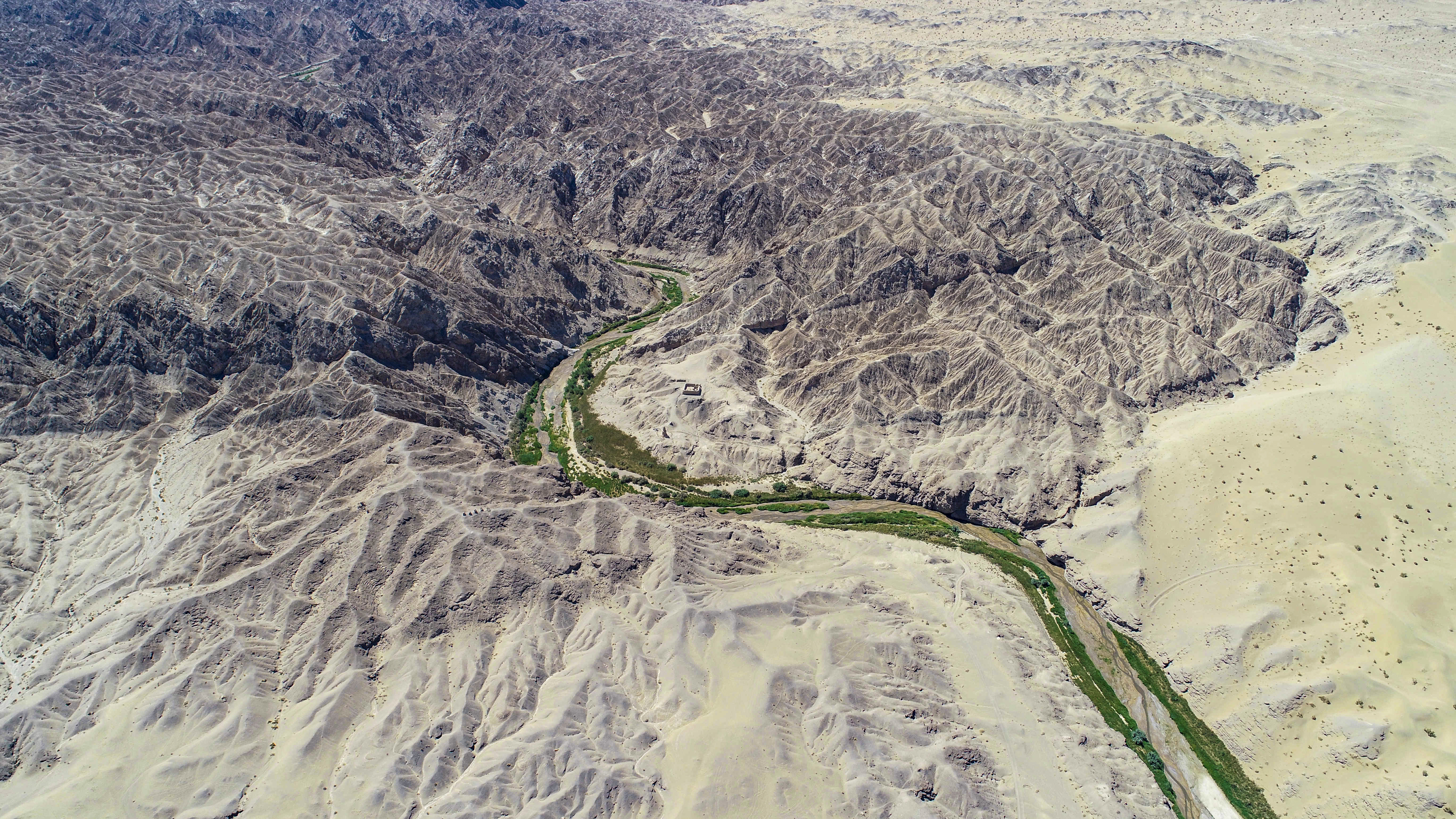
The Dangquan River originates from the Yema Mountain in Subei County on the western segment of the Qilian Mountains. As an inland river, it flows northward toward the Gobi desert north of the Mogao Grottoes in Dunhuang. The Dangquan River Basin spans across a land area of 1,114.6 square kilometers, with a primary channel extending up to 64.1 kilometers, an annual mean runoff of 252.6×10⁴ cubic meters, and an average flow rate of 0.08 cubic meters per second. The Dangquan River is formed by the Daquan Spring, which is why it is also known as the Daquan River. The water resulting from the melted ice and snow and the runoff of rainwater across the lateral ditches in the upstream Dangquan River permeates into the ground, which gives rise to an underground undercurrent. This subterranean undercurrent eventually surfaces as the Daquan Spring, Tiaohuzi Spring, and Kugou Spring in a low-lying area following its flow through the Yibaisi Gobi. These springs' outflows converge at Xiaolapai, forming an overland runoff that carves through the Sanwei Mountain to the north and thus shapes a river erosion landform. The Dangquan River is the only surface water source in the Mogao Grottoes region. Its downward erosion has played a significant role in shaping the steep cave walls. Additionally, it supplies ample water for the excavation projects and the monks who safeguard the temple. The Dangquan River has been instrumental in sustaining the Mogao Grottoes and the Dunhuang culture and is thus arguably the primary river that birthed the Mogao Grottoes.