 简体中文
简体中文

1.Crescent Spring
Crescent Spring(as shown in Picture 4-24) is called Shajin in the past and its popular name is Yaoquan. It had been one of “the Eight Sights of Dunhuang” since Han Dynasty and was named “Yue Quan Xiao Che”. Crescent Spring is about 200 meters long from east to west and about 25 meters long from south to north. The average depth of the spring is 0.8 meters. And it got the name as it is curved like a crescent. It has the reputation of “the First Spring in Desert”. The Crescent Spring in Mount Mingshashan is an magic splendor of spring. Crescent Spring is located in a depression between two paleo-alluvial-diluvial fans of Dang River and Xishuigou, which is beneficial for catchment. And due to the wind deposition, a huge amount of sandiness is piled up near the Southern part of Crescent Spring and around, which makes Crescent Spring form such a distinctive sand-spring-coexistence morphology.

Picture 4-24 Crescent Spring surrounded by Mount Mingshashan
2. Shule River
Shule River is an inland river (as shown in Picture 4-25). It rises in the northern foot of the west side of Qilian Mountains and flows into the northeast area of Dunhuang City through Changma, Yumen Town, etc. near Yangqiaozi. Before the 1960s, there often had tail water flowed into Dunhuang, joined Dang River and flowed west into Lop Nor. After the establishment of Anxi Twin Towers Reservoir in 1960, its lower reaches almost dried up and water courses were dried-up. Only during flood period there had water flowed into it (Dunhuang Records Compilation Committee, 2007).
Picture 4-25 Shule River
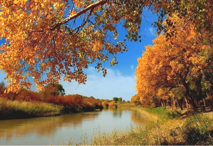
3. Dang River
Dang River (as shown in Picture 4-26), a inland river, belongs to Shule River and is the main river in Dunhuang City. It is the lifeblood of the oasis. The river water comes from Bengkundaban at Shule South Mountain of Qilian Mountain and the glaciers on the south and north slopes of Bayinzerikenwule and Nuogannuoer in the east part of Zailikemu and Danghe South Mountain. The source of Dang River is mainly supplied by the meltwater of the glacier on the north slope of Qilian Mountain. It flowed northwest through Beidangchengwan, lucaogou, langwan, past Dang River Reservoir and finally into the city. It is 380 kilometers long in total with a basin area of 16,800 square kilometers, annual average river runoff of 290 million m3, maximum discharge of 573m3/s and minimum discharge of 2.63m3/s.
From the source to Wulan cave dwelling is the upper reaches of Dang River and from Shazaoyuan (Dang River Reservoir) to its end is the lower reaches. According to the records of Dangchengwan hydrologicl station in middle reaches from the year 1962 to 1982, the annual average discharge is 9.39m3/s, the maximum charge during rainstorm and torrential flood is 200m3/s, the slope of upper reaches is 1/70—1/150, the slope of middle reaches is 1/100—1/300 and the slope of lower reaches is about 1/500. The lope of middle reaches is larger and its current is strongest. The vertical drop in some places is about dozens of meters, where has huge potential of generating capacity. Danghe enters into freeze-up period from the middle of November every year and begins to melt from the mid-to-late March of next year. Discharge in winter is the smallest and the discharge in August and September is larger. The water quality is sodium hydrogen carboant medium hard water. The density of hydrogen particle has strong alkalinity (Dunhuang Records Compilation Committee, 2007).
Picture 4-26 Dang River
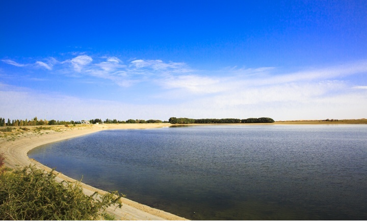
4. Danghe Reservoir
It is located in estuary of Danghe River in Dunhuang City and is 36 kilometers north of Dunhuang City. The basin area of dam site is 16,600 square kilometers, dam height is 46 meters, capacity of reservoir is 15,000,000 m3, crest elevation is 1421.5 meters. The reservoir is designed to withstand the worst flood in 50 years and is checked to withstand the worst flood in 500 years. It was constructed and put into operation in 1975. It has vast expanses of water with grand scale and is just like a splendid pearl in the western desert of Dunhuang.
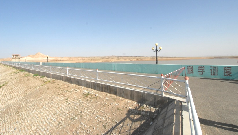
Picture 4-27 Danghe Reservoir